Which places list swimming?
Operator records list swimming at Livingston City Park, Obey River Park, Dale Hollow Lake Primitive Camping, Willow Grove Campground, Roaring River Park, Wartrace Creek Recreation Area, Lillydale Campground and Day Use, and Salt Lick Creek Recreation Area and Campground. Access and seasonal rules differ, so open the place record and its operator link before leaving.
Direct sources checked 2026-08-12: City of Livingston record 1; Recreation.gov record 2; Recreation.gov record 3; Recreation.gov record 4; Recreation.gov record 5; Recreation.gov record 6; Recreation.gov record 7; Recreation.gov record 8
Which places list a playground?
Operator records list a playground at Livingston City Park, Central Park (Livingston), Cinderella Park, Capshaw Park, Dogwood Park, Roaring River Park, Wartrace Creek Recreation Area, and Salt Lick Creek Recreation Area and Campground. Those listings do not settle hours, accessibility, or present condition.
Direct sources checked 2026-08-12: City of Livingston record 1; Central Park Livingston record 2; City of Cookeville record 3; City of Cookeville record 4; City of Cookeville record 5; Recreation.gov record 6; Recreation.gov record 7; Recreation.gov record 8
Which places list hiking?
Operator records list hiking at Monterey Rail Trail, Dale Hollow Damsite Recreation Area, Bee Rock, Willow Grove Campground, Meadow Creek Park, Lillydale Campground and Day Use, and Salt Lick Creek Recreation Area and Campground. Route length, surface, difficulty, and closures remain open unless the individual place record says otherwise.
Direct sources checked 2026-08-12: Town of Monterey record 1; Recreation.gov record 2; Recreation.gov record 3; Recreation.gov record 4; Recreation.gov record 5
Which records state a $5 vehicle day-use fee?
Obey River Park, Pleasant Grove Recreation Area (Dale Hollow Lake), Roaring River Park, Wartrace Creek Recreation Area, and Lillydale Campground and Day Use each list a $5 vehicle day-use fee. Open the individual record for walk-in, pass, or payment-method details and recheck the operator before travel.
Direct sources checked 2026-08-12: Recreation.gov record 1; Recreation.gov record 2; Recreation.gov record 3; Recreation.gov record 4; Recreation.gov record 5
Which campground records explicitly say they are seasonal?
Obey River Park, Willow Grove Campground, Lillydale Campground and Day Use, and Dale Hollow Lake (USACE Nashville District) list a seasonal campground or beach schedule. Their operator pages, not this directory, govern current opening dates.
Direct sources checked 2026-08-12: Recreation.gov record 1; Recreation.gov record 2; Recreation.gov record 3; U.S. Army Corps of Engineers record 4
Which places list an overlook?
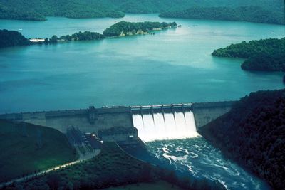
Dale Hollow Dam Overlook and Bee Rock are the two operator records that list an overlook. That does not describe view quality, trail condition, or crowd level.
Direct sources checked 2026-08-12: U.S. Army Corps of Engineers record 1; Town of Monterey record 2